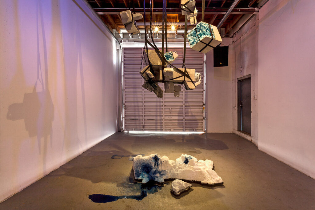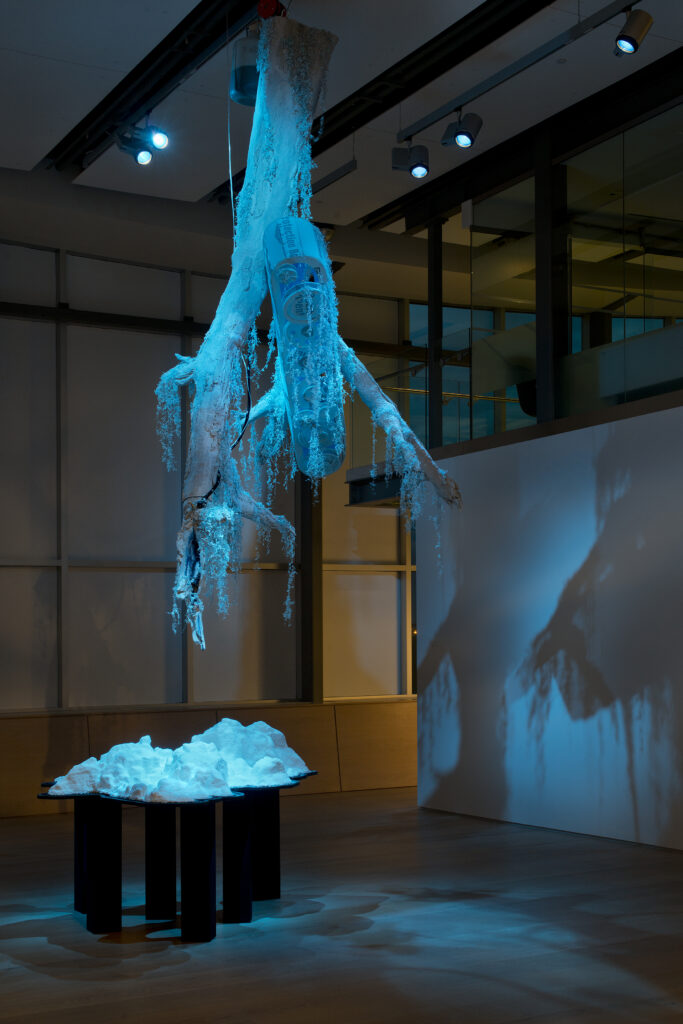
IN 2015, I collaborated with climate scientist Dr. Grant Deane of the Scripps Institute of Oceanography and Assistant Professor at UC San Diego to create MESH. While conducting sculptural research in the Bayou Isle De Jean Charles and Bayou Pointe Aux Chien, I took 3d scans of vulnerable land soon to be consumed by the rising Gulf of Mexico. I used these scans to produce two identical land replicas, and cast each of them in salt.
Mesh was produced specifically to be shown in two simultaneous exhibitions. One in Miami, and one in Calgary. I considered the relationship between these two cities. Dr. Grant Deane and I streamed 4 consecutive months glacial sonic activity recorded using hydrophones beneath the Hjorsund Fijord in Svalbard. This audio was captured by colleagues of Dr. Deane from the Polish Polar Station. This audio was streamed in both galleries at the same time. Every time there was a major calving event, the thunderous sound of a collapsing glacier would trigger a solenoid, which opened a valve releasing a few small drops of Aniline dye onto the salt formation. This re-coloration of the cast salt land formations became a physical record of glacial loss over the course of the exhibitions.
This piece not only considers the multitude of ways that the Arctic, The Gulf Coast and the mines of Northern Alberta are connected, but also provokes questions about Land Rights, colonization and Indigenous land exploitation using a 3d scanner.